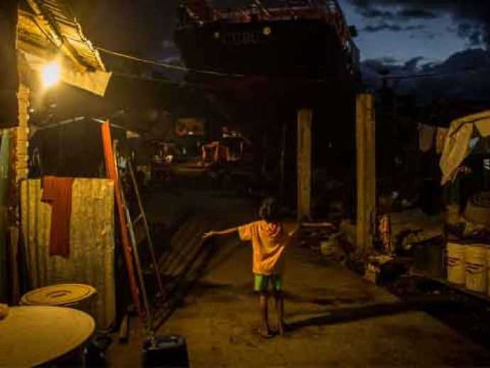
(jokapatha village in Chhattisgarh gets electricity for the first time post independence)
Jokapatha a tribal village in the Balrampur district of Chhattisgarh state got electricity connection for the first time. The tribal village is situated in the mountainous region of the state. The village had been deprived of power since independence.

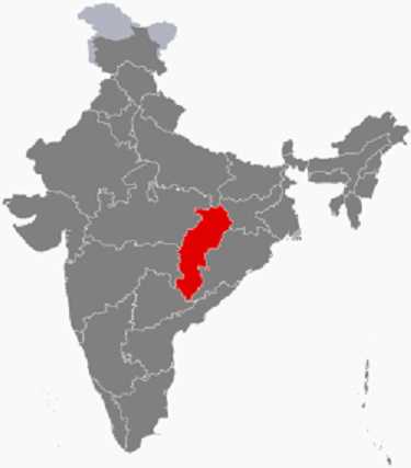
(location of Chhattisgarh on the map of India)
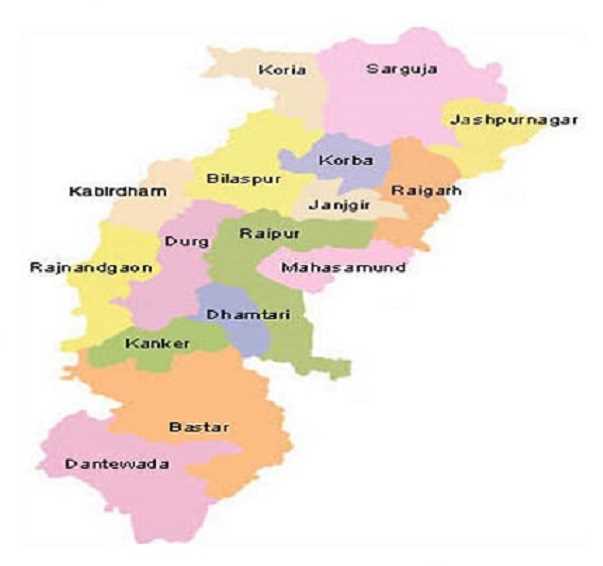
Chhattisgarh is one of the 29 states of India. It was formed on 1st November 2000. It was formed by partitioning the southeastern districts of the state of Madhya Pradesh. The capital of Chhattisgarh is Raipur. There are a total of 27 districts in the state with Raipur being the largest city. Chhattisgarh is the 17th most populated state in the country with a total population of 25,545,198. Located in the centre east of the country, Chhattisgarh is the tenth largest state of the country. Chhattisgarh shares its borders with the state of Uttar Pradesh in the north, Jharkhand in the northeast, Madhya Pradesh in the northwest, Telangana and Andhra Pradesh in the south, Odisha in the southeast and Maharashtra in the southwest. The total area of the state is 135,191 sq km (52,198 sq mi). Chhattisgarh is a unicameral legislature with 90 seats. The Chief Minister of Chhattisgarh is Dr Raman Singh (born on 15th October 1952) who belongs to the Bharatiya Janta Party (BJP). The Governor of the state is Balram Das Tandon (born on 1st November 1927). Chhattisgarh is a resource-rich state of the country with a source of steel and electricity. Chhattisgarh is the fastest developing state of India and accounts for 15% of the total steel production of the country.

(map of Chhattisgarh)
As per the 2011 census, the literacy rate of Chhattisgarh is 70.01%. The state animal of Chhattisgarh is the wild Asian buffalo. Sal tree is the state tree of Chhattisgarh and Hill Myna is the state bird. The official language of the state is Hindi.